This manual was last updated 12 November 2012 for version 0.7.0 of ecmdb.
Copyright © 2012
Computer Graphics Group, University of Siegen, Germany.
Written by Martin Lambers (martin.lambers@uni-siegen.de).
See http://www.cg.informatik.uni-siegen.de/ for contact information.
Copying and distribution of this file and the accompanying media files, with or without modification, are permitted in any medium without royalty provided the copyright notice and this notice are preserved. These files are offered as-is, without any warranty.
Short Contents:
ecmdb is a tool to create and manage ECM databases.
ECM (Ellipsoidal Cube Map) databases store data for the surface of a planetary object, for example photos and elevation models of Earth, Moon, or Mars. An ECM database can be used by a rendering program to efficiently display huge data sets.
For more information about ECM, see http://ecm-planet.sourceforge.net/.
Building an ECM database can be computationally expensive. To make best use of multi-processor systems and clusters, this task is split into multiple steps:
ecmdb create to create a database. This step defines the
database category (e.g. elevation or texture data), its maximum resolution, and
the ellipsoid for which it provides data.ecmdb create --help for more information. To find the right maximum
resolution, see ecmdb resolutions --help.
ecmdb add to add input files to your data base. The
input files must contain georeference information. They can be in any format
that GDAL understands.ecmdb add --help for more information.
ecmdb commit.commit command can be used on a given database at any given time,
but you can still run more add commands in parallel or after the
commit command; you just need to rerun commit afterwards to use the
new files.ecmdb commit --help for more information.
ecmdb finalize to remove all management information from
the database and save disk space. Note that you cannot add or commit more input
files to a finalized database.ecmdb finalize --help for more information.
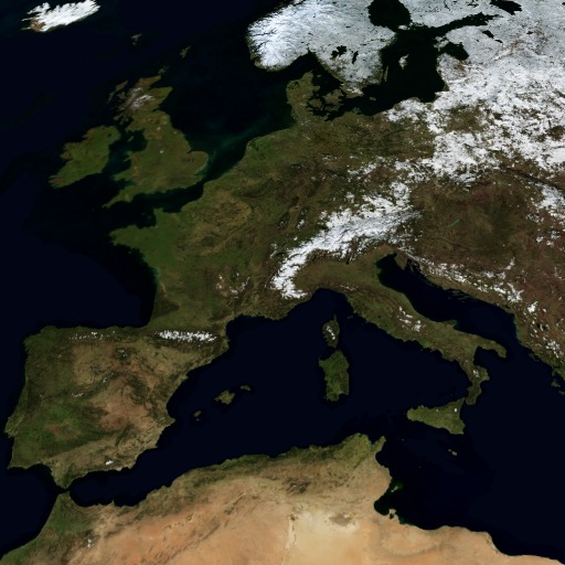
The BMNG data set consists of 12 Earth surface images for the months of the year 2004, and an elevation model.
To build an ECM database from the image for January, do the following:
world.200401.3x21600x21600.*.jpg) from ftp://mirrors.arsc.edu/nasa/world_500m/.
          gdal_translate -of VRT -a_srs WGS84 -a_ullr -180 90 -90   0 world.200401.3x21600x21600.A1.jpg 200401.A1.vrt
          gdal_translate -of VRT -a_srs WGS84 -a_ullr -180  0 -90 -90 world.200401.3x21600x21600.A2.jpg 200401.A2.vrt
          gdal_translate -of VRT -a_srs WGS84 -a_ullr  -90 90   0   0 world.200401.3x21600x21600.B1.jpg 200401.B1.vrt
          gdal_translate -of VRT -a_srs WGS84 -a_ullr  -90  0   0 -90 world.200401.3x21600x21600.B2.jpg 200401.B2.vrt
          gdal_translate -of VRT -a_srs WGS84 -a_ullr    0 90  90   0 world.200401.3x21600x21600.C1.jpg 200401.C1.vrt
          gdal_translate -of VRT -a_srs WGS84 -a_ullr    0  0  90 -90 world.200401.3x21600x21600.C2.jpg 200401.C2.vrt
          gdal_translate -of VRT -a_srs WGS84 -a_ullr   90 90 180   0 world.200401.3x21600x21600.D1.jpg 200401.D1.vrt
          gdal_translate -of VRT -a_srs WGS84 -a_ullr   90  0 180 -90 world.200401.3x21600x21600.D2.jpg 200401.D2.vrt
          ecmdb create   /ecmdb/bmng/200401 -E earth-wgs84 -q 512 -l 7 -C texture
          ecmdb add      /ecmdb/bmng/200401 200401.*.vrt
          ecmdb commit   /ecmdb/bmng/200401
          ecmdb finalize /ecmdb/bmng/200401
To build an ECM database from the elevation model, do the following:
tmp-elevation.vrt with the following contents:
          <VRTDataset rasterXSize="86400" rasterYSize="43200">
            <VRTRasterBand dataType="Int16" band="1" subClass="VRTRawRasterBand">
              <SourceFilename relativetoVRT="1">/vsigzip/srtm_ramp2.world.86400x43200.bin.gz</SourceFilename>
              <ImageOffset>0</ImageOffset>
              <PixelOffset>2</PixelOffset>
              <LineOffset>172800</LineOffset>
              <ByteOrder>MSB</ByteOrder>
            </VRTRasterBand>
          </VRTDataset>
gdal_translate -of VRT -a_srs WGS84 -a_ullr -180 90 180 -90 tmp-elevation.vrt elevation.vrt
          ecmdb create   /ecmdb/bmng/elevation -E earth-wgs84 -q 512 -l 7 -C elevation
          ecmdb add      /ecmdb/bmng/elevation elevation.vrt
          ecmdb commit   /ecmdb/bmng/elevation
          ecmdb finalize /ecmdb/bmng/elevation
Various artificial, low-resolution images of the Earth surface are available from the Natural Earth project.
The files provided by this project can be imported directly. For example:
     ecmdb create   /ecmdb/naturalearth/hyp-hr -E earth-wgs84 -q 512 -l 5 -C texture
     ecmdb add      /ecmdb/naturalearth/hyp-hr HYP_HR/HYP_HR.tif
     ecmdb commit   /ecmdb/naturalearth/hyp-hr
     ecmdb finalize /ecmdb/naturalearth/hyp-hr
The SRTM 90m Digital Elevation Database version 4 is available from http://srtm.csi.cgiar.org/. It provides elevation data for the land masses of Earth.
First, get all the ZIP files from ftp://xftp.jrc.it/pub/srtmV4/tiff/. You don't need to unzip them; instead, you can build a list of special file names that allow GDAL to read the ZIP contents directly:
for i in *.zip; do echo /vsizip/$i/`basename $i .zip`.tif; done > addlist.txt
Then:
     ecmdb create   /ecmdb/srtm4 -E earth-wgs84 -q 512 -l 9 -C elevation
     ecmdb add      /ecmdb/srtm4 `cat addlist.txt`
     ecmdb commit   /ecmdb/srtm4
     ecmdb finalize /ecmdb/srtm4
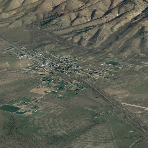
The Utah GIS portal provides lots of great high-quality data sets.
This is a high-resolution (ca. 25 cm ground resolution) image data set stored in 3239 TIFF files. Get them all from
ftp://ftp.agrc.utah.gov/Imagery/HRO2006/ (you only need the .tif files).
One of the files has corrupt GeoTIFF headers. You can fix it with this command:
     gdal_translate -a_srs "epsg:26912" 12SWJ320760.tif fixed-12SWJ320760.tif
     mv fixed-12SWJ320760.tif 12SWJ320760.tif
Then build the ECM database:
     ecmdb create   /ecmdb/utah-hro2006 -E earth-wgs84 -q 512 -l 18 -C texture
     ecmdb add      /ecmdb/utah-hro2006 *.tif
     ecmdb commit   /ecmdb/utah-hro2006
     ecmdb finalize /ecmdb/utah-hro2006
You may want to run multiple concurrent add commands in a cluster
because this will take some time.
With lossless compression, all steps took 114 hours and 54 minutes on a single
Intel Core i7-930 machine.
Now lossy compression is supported and is the default; this should result in
better performance and significantly reduced disk usage.
The Utah GIS portal provides various elevation models, e.g. a 2m model (at ftp://ftp.agrc.utah.gov/DEM_2m/) and a 5m model (at ftp://ftp.agrc.utah.gov/Imagery/DEM_5m/).
To build a database from the 2m model:
     ecmdb create   /ecmdb/utah-2m -E earth-wgs84 -q 512 -l 15 -C elevation
     ecmdb add      /ecmdb/utah-2m --min=-9000 --max=+9000 --srs "+proj=utm +zone=12 +datum=NAD83" *.asc
     ecmdb commit   /ecmdb/utah-2m
     ecmdb finalize /ecmdb/utah-2m
For the 5m model, use -l 14 for the create command due to the lower resolution.
Several TerraSAR-X demonstration datasets are available from the TerraSAR-X Sample Imagery Site.
The files can be imported directly. Be sure to select a geocoded file in GeoTIFF format.
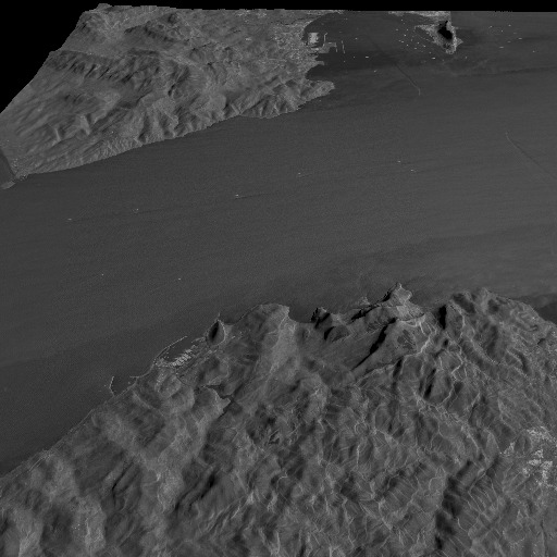
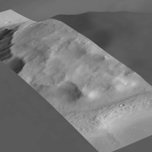
The example shown above is from the TerraSAR-X StripMap Image of the Strait of
Gibraltar (plus a DEM and a little lighting). In StripMap mode, TerraSAR-X
achieves a resolution of up to 3 m on ground, which according to ecmdb
resolutions corresponds to level 13 (with a quad size of 512). So we need 14
levels (0-13) to store the data without resolution loss.
     ecmdb create   /ecmdb/terrasar-x/gibraltar -E earth-wgs84 -q 512 -l 14 -C sar-amplitude
     ecmdb add      /ecmdb/terrasar-x/gibraltar IMAGE_HH_SRA_strip_008.tif
     ecmdb commit   /ecmdb/terrasar-x/gibraltar
     ecmdb finalize /ecmdb/terrasar-x/gibraltar
This elevation model is available here: http://wms.lroc.asu.edu/lroc/global_product/100_mpp_DEM.
Get the files WAC_GLD100_*_100M.IMG from http://lroc.sese.asu.edu/data/LRO-L-LROC-5-RDR-V1.0/LROLRC_2001/DATA/SDP/WAC_DTM/.
Build an ECM database:
     ecmdb create   /ecmdb/moon-wac100m -E moon-nasa -q 512 -l 7 -C elevation
     ecmdb add      /ecmdb/moon-wac100m WAC_GLD100_*_100M.IMG
     ecmdb commit   /ecmdb/moon-wac100m
     ecmdb finalize /ecmdb/moon-wac100m
See http://www.msss.com/mgcwg/mgm/. Get all the data files mcXX-256.img, where XX ranges from 02 to 30.
Additionally, get the file number 1, which uses only one digit: mc1-256.img.
Build an ECM database:
     ecmdb create   /ecmdb/mars-moc -E mars-nasa -q 512 -l 7 -C texture -c 1
     ecmdb add      /ecmdb/mars-moc mc*-256.img
     ecmdb commit   /ecmdb/mars-moc
     ecmdb finalize /ecmdb/mars-moc
See http://pds-geosciences.wustl.edu/missions/mgs/megdr.html. You need
the files megt*.lbl and megt*.img in the best available resolution.
These can be found in the MEG128 and POLAR directories. From the
POLAR directory, you only need the megt_?_512_1.* files.
Build an ECM database:
     ecmdb create   /ecmdb/mars-mola -E mars-nasa -q 512 -l 6 -C elevation
     ecmdb add      /ecmdb/mars-mola megt*.lbl
     ecmdb commit   /ecmdb/mars-mola
     ecmdb finalize /ecmdb/mars-mola
The HiRISE project provides high-resolution images of Mars.
Unfortunately it is not easy to get the correct data files from their website. You have to click your way through.
The files you need are high-resolution .JP2 files.
The JPEG2000 format is poorly supported in general. I had to use the proprietary Kakadu software to produce a TIFF file that is readable by all common tools:
kdu_expand -i PSP_008648_1810_RED.JP2 -o PSP_008648_1810_RED.tiff
Since ECM databases do not yet support color definitions beyond 8 bit per channel, you need to tell GDAL to reduce the original 10 bit color range to 8 bit:
gdal_translate -of VRT -scale 0 1023 0 255 PSP_008648_1810_RED.tiff hirise.vrt
Now you can import the file:
     ecmdb create   /ecmdb/mars-hirise -E mars-nasa -q 512 -l 16 -C texture -c 1
     ecmdb add      /ecmdb/mars-hirise --min 1 hirise.vrt
     ecmdb commit   /ecmdb/mars-hirise
You can add and commit more HiRISE images to the same database (even if they are from completely different locations) before finalizing it.